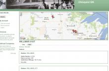
A Google map implementation that renders a Google map block based on geo microformat tags embedded in a page.
The locations placed on the google map are obtained by analysing the current page for GEO microformat informaton. When this info exists, a map will be rendered, when there is no location information, no map will appear.
More information on GEO Microformats: http://microformats.org/wiki/geo
There have been a few updates to the GEO microformat since this was originally written, so not every form of the microformat is currently supported.
Example data:
  <div class="geo" title="Canterbury">
    Canterbury, United Kingdom
    <span class="latitude" title="51.2667">[latitude display]</span>
    <span class="longitude" title="1.08333">[longitude display]</span>
  </div>
Why use this form of mapping ?
The advantage of using this method is that there is no need to do anything fancy to link dynamic data with a map view. If your node teasers contain geo data, then a map will appear and plot the data. The map will zoom to fit all markers.
Limitations
At the moment, the javascript is not really themeable. There will need to be some work done to make maps options customizable.
Sponsorship