Still on Drupal 7? Security support for Drupal 7 ended on 5 January 2025. Please visit our Drupal 7 End of Life resources page to review all of your options.
The Views PSPP module allows a view to be displayed/exported in PSPP format. The module was heavily inspired by the Views Bonus Pack Export module. The module simply adds these two new styles to the Feed display:
PSPP Syntax used to describe the PSPP syntax.
PSPP CSV used to describe export data.
About PSPP
PSPP is a program for statistical analysis of sampled data. It is a Free replacement for the proprietary program SPSS, and appears very similar to it with a few exceptions. PSPP is a free Software licensed under GPLv3 or later.
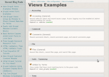
A collection of views examples that can be turned on and used directly within views. You can use the views examples as-is on your site, or you can clone them and use them as a starting point for further customized views.
Although this module works, it will likely be rewritten as a features package in the future.
How to Use
Enable views and views_examples modules.
Go to views_examples settings page: /admin/settings/views_examples
Turn on the examples you would like to try out. Some examples require additional modules which are noted. You won't be able to enable those examples until the required modules are enabled.
Go to views build page: /admin/build/views. The enabled examples will be shown.
Click "clone" for any example you want to edit. This is not strictly necessary (you can simply edit the example view itself) but, if you clone it instead, you will be left with the original example view for reference.
Edit your cloned version and play around. Preview results of the view at the bottom of the page by choosing the display and then clicking the Preview button.
Have fun!!
Current Views Examples
Most of the examples thus far are fairly simple. One more complicated one is the Similar by Terms example.
Integration between Privatemsg, Views and Views Bulk Operations. Allows to create lists of private messages using Views and also provides optional Privatemsg UI based on Views.
ct_gearth is a new content type based on the Google Earth API. Users can attach .kml files to a node (with upload module), which in turn is displayed through the Google Earth API. If a user attaches several .kml files it is possible to choose between them via a drop-down box.
This module is part of a package of modules being developed by Jefferson Institute. These modules are meant to serve as tools for data visualization:
Timelinemap - It allows you to load one or more data sets onto both a map and a timeline simultaneously. Only items in the visible range of the timeline are displayed on the map. Timeline Map displays data represented in the timeline as markers on Google map.
Google Visualization API - It uses Google Visualization API to display different types of charts. Pie, Bar, Column, Gauge, GeoMap, IntensityMap, Area, MotionChart and Scatter plot are supported at the moment.
TagMap - Display a geo-coded tag cloud over Google Map. Taxonomy terms or imported external data can be displayed.
GVS module was built as Views 2 style plug-in. It uses Google Visualization API to display different types of charts. Pie, Bar, Column, Area, Line, Gauge, GeoMap, IntensityMap, MotionChart, Treemap, Annotated Time Line and Scatter plot are supported at the moment. In views style setting users can choose the fields (data), chart type and some options that they want to be displayed.
This module is part of a package of modules being developed by Jefferson Institute. These modules are meant to serve as tools for data visualization:
Timelinemap - It allows you to load one or more data sets onto both a map and a timeline simultaneously. Only items in the visible range of the timeline are displayed on the map. Timeline Map displays data represented in the timeline as markers on Google map.
KML content type - Users can attach .kml files to a node (with upload module), which in turn is displayed through the Google Earth API. If a user attaches several .kml files it is possible to choose between them via a drop-down box.
TagMap - Display a geo-coded tag cloud over Google Map. Taxonomy terms or imported external data can be displayed.