GeoJoin Documentation
Last updated on
30 April 2025
Current Version
Functions:
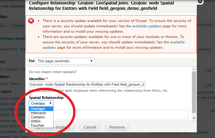
- Join Operators: Overlaps, Within, Contains, and Intersects - Will join features in a single GeoField instance based on operator selected in Relationship UI dialog. Features must have the same SRID - two features with NULL SRID will not match.
- PostGIS / MySQL Detection - tests for "GeomFromText" method in mysql databases and Postgis_Version in PostgreSQL databases in the relationship -> query() method, otherwise query() returns false.
Example
An example of the functioning GeoJoin in Views can be seen here: http://deq3.bse.vt.edu/d.dev/?q=geojoin-test . This example has a collection of points, lines and polygons that represent river flow gages, river segments and watersheds. The first tab "All" shows a list of these shapes. By clicking on any of these shapes you will be taken to the "Contains" tab for that shape which will show all of the shapes in the data set that are contained by that shape. Similarly, the "Overlaps" and "Within" tab present the shapes that either "OVerlap" the shape in question or that the shape in question is "Within".
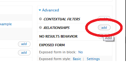
Adding a GeoJoin in Views
Add a Relationship
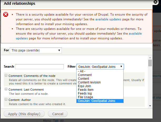
Use Filter to See only GeoJoin Types
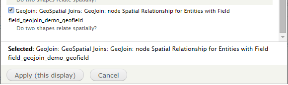
Select from Available GeoJoins
Define Your Spatial Operator to Join on
Help improve this page
Page status: Not set
You can:
You can:
- Log in, click Edit, and edit this page
- Log in, click Discuss, update the Page status value, and suggest an improvement
- Log in and create a Documentation issue with your suggestion
