 Support for Drupal 7 is ending on 5 January 2025—it’s time to migrate to Drupal 10! Learn about the many benefits of Drupal 10 and find migration tools in our resource center.
This module provides a field for geospatial data that can be added to entities. To the end user this module is similar to the Geofield module, but spatial operations and data storage rely on PostGIS. The module is developed as part of the Cartaro distribution but can be used on its own, too.
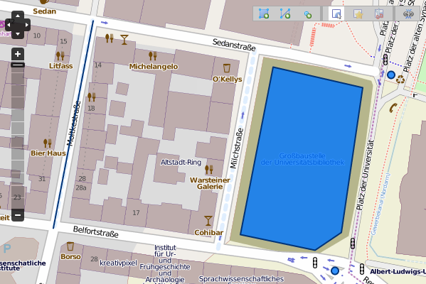
Using the OpenLayers Editor module to edit geospatial data stored in a PostGIS database:

Requirements
- PostGIS 1.5 or later. Some features might work with older versions.
- OpenLayers module if you want to display geospatial data on maps.
Related Projects
- The Cartaro distribution integrates this module with the GeoServer module.
- The Feeds module enables you to import, from CSV files, geospatial data stored as KML, WKT or GML.
- For a complete geospatial data parser, the GDAL module together with Feeds module allows read and import vector data from OGR web services or files in all formats supported by the GDAL/OGR library.
Documentation
- See the PostGIS module in the Site Building Guide.
- Screencast about the PostGIS module.
Project information
- Module categories: Site Structure
37 sites report using this module
- Created by geops on , updated
Stable releases for this project are covered by the security advisory policy.
Look for the shield icon below.
Releases
7.x-1.5
 released 29 October 2015
Works with Drupal: 7.x
✓ Recommended by the project’s maintainer.
Development version: 7.x-1.x-dev updated 13 Oct 2015 at 17:23 UTC


