
Active
Project:
Geocluster
Version:
7.x-1.x-dev
Component:
Documentation
Priority:
Normal
Category:
Task
Assigned:
Unassigned
Issue tags:
Reporter:
Created:
9 Oct 2012 at 10:50 UTC
Updated:
9 Oct 2014 at 14:51 UTC
Jump to comment: Most recent, Most recent file


Comments
Comment #0.0
dasjoupdate
Comment #0.1
dasjoup
Comment #0.2
dasjoup
Comment #0.3
dasjoadd links
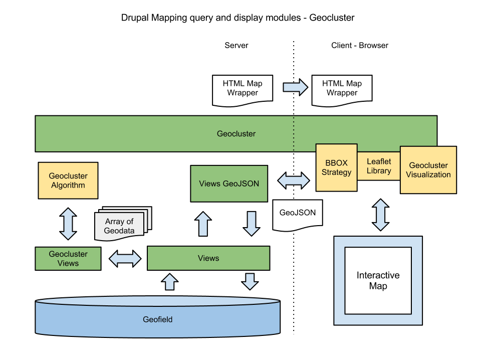
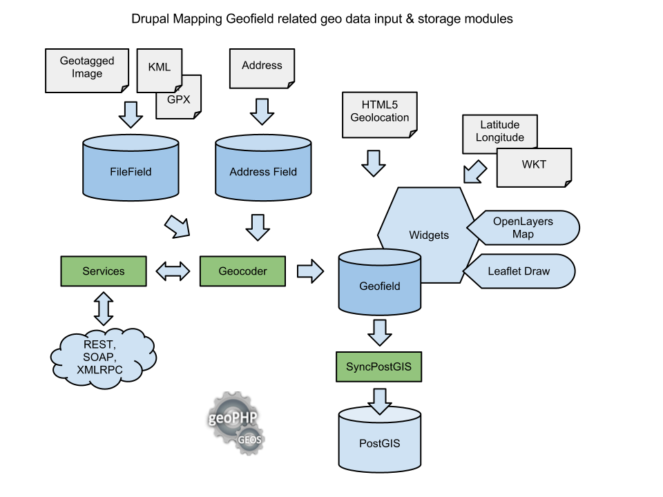
Comment #1
dasjoadding geocluster diagram
Comment #1.0
dasjofix
Comment #1.1
dasjoadded geocluster
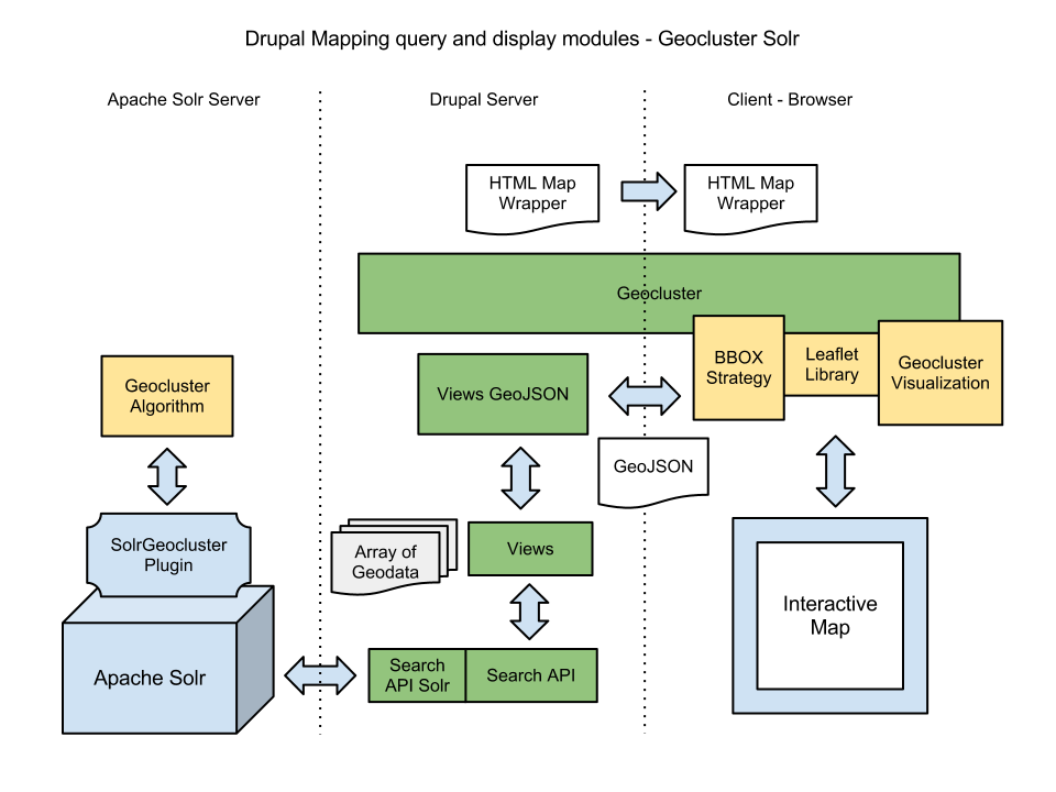
Comment #2
dasjoadding geocluster solr diagram
Comment #2.0
dasjofix
Comment #3
levelos commentedThis is amazing @dasjo, incredibly helpful! One comment I have is that you can also use the interactive map, E.g., Leaflet, to query the geodata directly and not rely on geodata dumped to the browser in JS. E.g., on one recent project we're have a click even that looks to see if the clicked coordinates are within a feature on our geo server and, if so, open a popup with some metadata. So maybe an arrow from the map to the geo database via a service?
Comment #4
dasjothanks for the feedback levelos.
not relying on geodata dumped to the browser in JS is definitely of interest here. i have already incorporated that model for the geocluster implementation: here i'm using views_geojson + a custom leaflet bbox strategy to query the geodata dynamically.
http://drupal.org/node/1807358#geocluster
currently i have limited the diagrams to explaining how the modules behave with drupal by default. maybe i will add some further scenarios for data fetching with external sources as geoserver.
i will try to contribute the leaflet bbox strategy officially as geocluster evolves. currently it lives here
http://drupalcode.org/project/geocluster.git/blob/refs/heads/7.x-1.x:/js...
openlayers already supports such a bbox strategy that works with views_geojson out-of-the-box.
Comment #5
dasjolatest diagrams:
https://drive.google.com/#folders/0B9p5ry3z0BdLekpKUFRqbGE4bTQ
Comment #5.0
dasjoadded geocluster solr
Comment #6
dasjoa screenshot of the GeoRecruiter use case based on DrupalJobs
Comment #7
chriscalip commenteddasjo,
is that a progressive clustering implemented ;) that looks nice.
Comment #8
dasjohi chris,
its actually just server-side, because markercluster currently doesn't support easy integration of geocluster.
i have some minor customizations on that site that still need to get committed for geocluster.
regards
Comment #8.0
dasjoadded sources link
Comment #9
robertwb commentedThis is great stuff @dasjo