
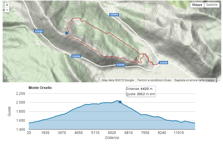
The GPX Track & Elevation module allows you to show a map and an elevation profile from GPX files using the google maps and visualization api.
The module takes into account only the trk and wpt tags (Tracks and Waypoints) and ignores the rte tags (Routes).
The elevations will be parsed from the ele tag of the gpx file, so this module is useless if your gpx files does not include the optional ele tag.
Given a gpx file the module will consider every trk tag as a single stage of the whole track: all of them will be represented on the same map, but everyone will have a dedicated elevation profile named as the title tag of the track.
The map and the elevation profiles are linked, so moving the mouse on the profile will highlight the corresponding point on the map.
It is also possible enabling the link in the reverse way: pointing the mouse on the track will highlight the corresponding point on the elevation profiles.
Any wpt registered in the GPX file will appear on the same map of the tracks.
DRUPAL 7 vs DRUPAL 8
The main difference between Drupal 7 and Drupal 8 difference is that Drupal 7 version creates an "Elevation profile" field that can be linked to file type field containing a GPX file while the Drupal 8 version will create a formatter for file type field.
Project information
- Module categories: Content Display, Site Structure
 63 sites report using this module
- Created by riccardino on , updated
 Stable releases for this project are covered by the security advisory policy.
Look for the shield icon below.
Releases
7.x-1.3
released 9 March 2018
Works with Drupal: 7.x
✓ Recommended by the project’s maintainer.
Development version: 7.x-1.x-dev updated 9 Mar 2018 at 10:03 UTC


